Find aquaplaning issues before they cost you a deadline.
Check every flow path on your highway design in minutes, not days, and fix problems while they are still a design change. Import your 12d, Civil 3D, OpenRoads, DXF or IFC surface and get review-ready evidence for every failing location.
Gallaway water film depth methodWhole-corridor assessment14 days free
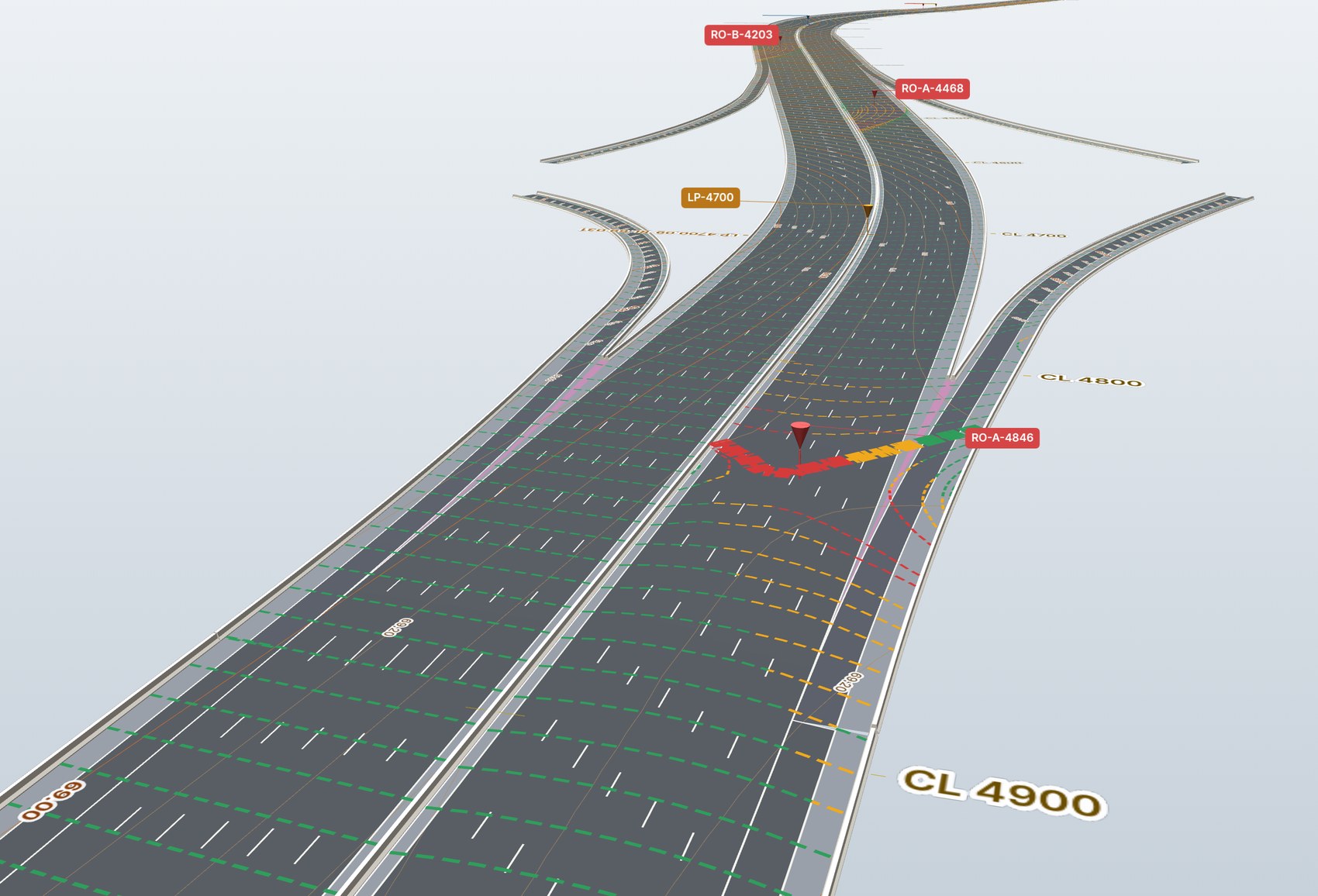
Manual aquaplaning assessment breaks down at corridor scale.
You can’t reliably check every path by hand
Critical flow paths get missed when a design has kilometres of lanes, ramps, transitions and superelevation rollovers.
Late findings mean another design cycle
A problem found after the geometry is advanced means redesign, new drawings, updated quantities and another review.
Proving the check takes almost as long as doing it
Reviewers still need chainages, plans, screenshots, tables and calculations they can verify.
And the one that matters most: your name is on the design.
Water film depth is a safety criterion. Aquaplaning happens at highway speed, in heavy rain, on exactly the flow path nobody checked. If it ever comes to an incident review, the first question is what the design assessment covered. “We checked the sections we could” is not an answer you want to give.
From 3D surface to review-ready evidence.
Import the design surface
Assess every flow path
Water film depth, drainage path length, chainage, carriageway and risk level.
Export a defensible assessment
Failure locations, plans and images, calculation tables, and PDF and Word reports.
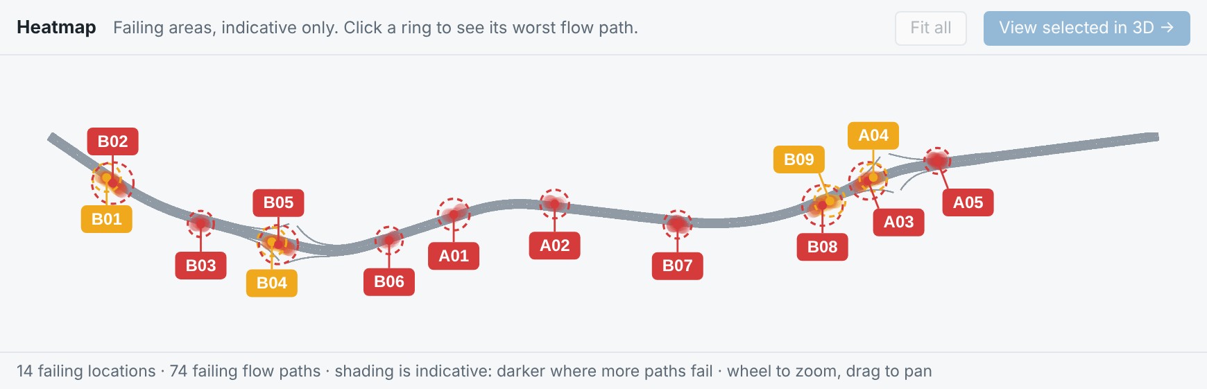
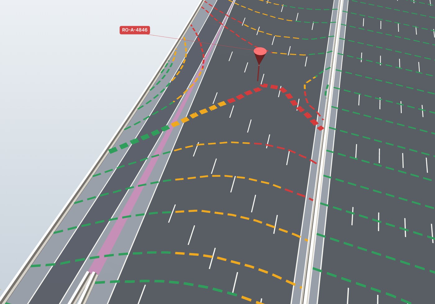
Prefer to see it run? Watch the walkthrough video
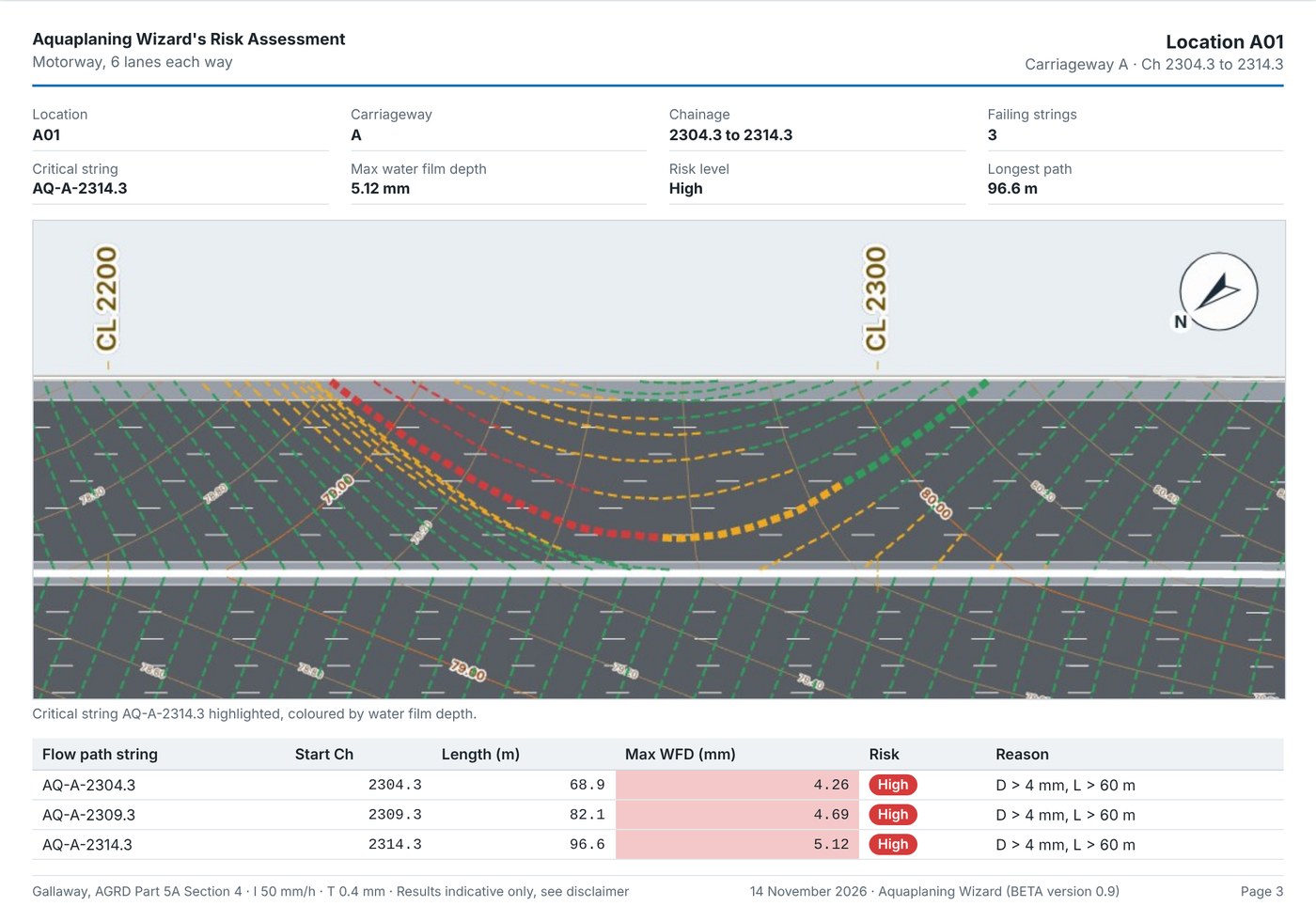
Answer the reviewer’s questions on one page.
- Where is the issue?Location A01, shown on the key plan and on its own plan
- Which carriageway and chainage?Carriageway A · Ch 2304.3 to 2314.3
- How deep is the water film?Up to 5.12 mm against a 4 mm absolute limit · High
- What calculation supports it?Point-by-point table: length, height, equal-area slope and depth
Built around the assessment workflow engineers already use.
The Gallaway water film depth method, applied to every flow path and shown in full.
Your limits, your criteria
Configurable desirable and absolute water film depth limits, rainfall intensity, texture depth and drainage path length.
Nothing hidden
Inspectable path geometry, equal-area slope and the calculation at every point of every path.
Evidence tied to location
Results exported with carriageway, chainage, plans and tables, ready for review.
Checked on every run. 26 automated checks, including a recalculation of a published worked example whose depths the app reproduces. Results are indicative and must be reviewed by a qualified engineer.
Priced for one avoided review cycle, not another CAD licence.
14-day free trial
Run the assessment on your own design, up to the first 10 km of road, with a simple PDF report. No card needed.
Start your free trial →One highway, fully assessed
A complete corridor assessment with unlimited road length and review-ready reporting.
Request project pricingFor teams with several corridors
Assess every highway design your team produces, month after month.
Request monthly pricingTry it on your next highway design.
Register in about two minutes and start your 14-day free trial straight away.
- Your own design, first 10 km of road
- Every flow path, with water film depth and risk
- Simple PDF report of the critical locations
- Runs in your browser; your design stays on your computer
We never share your details. Privacy Notice
Loading…
Start your free trial
Two short steps. Your 14-day trial starts as soon as you register.
Sign in
Welcome back. Sign in to open the Aquaplaning Wizard.
Reset your password
Enter the email you registered with. If it has an account, we will email you a link to choose a new password. The link works once, for 30 minutes.
Choose a new password
Choose a new password for your account. Saving it signs you out on every other device.
Check your email
We have sent you an email with a link.
The email comes from Aquaplaning Wizard <no-reply@dcca.au>. If it has not arrived in a few minutes, check your spam or junk folder.
Your account
Please confirm your email to open the app. We sent a link to when you registered.
Your free trial has ended.
Keep using the Aquaplaning Wizard
Subscribe per project or monthly for unlimited road length, detailed and Word reports, and no watermark. Send a request and we will get back to you with pricing.
Opens in a new tab. Works best on a laptop or desktop in Chrome, Edge or Safari.
Change password
Delete my account
Use it on your next highway design.
Find the flow path that fails before your reviewer does.